decidim geo
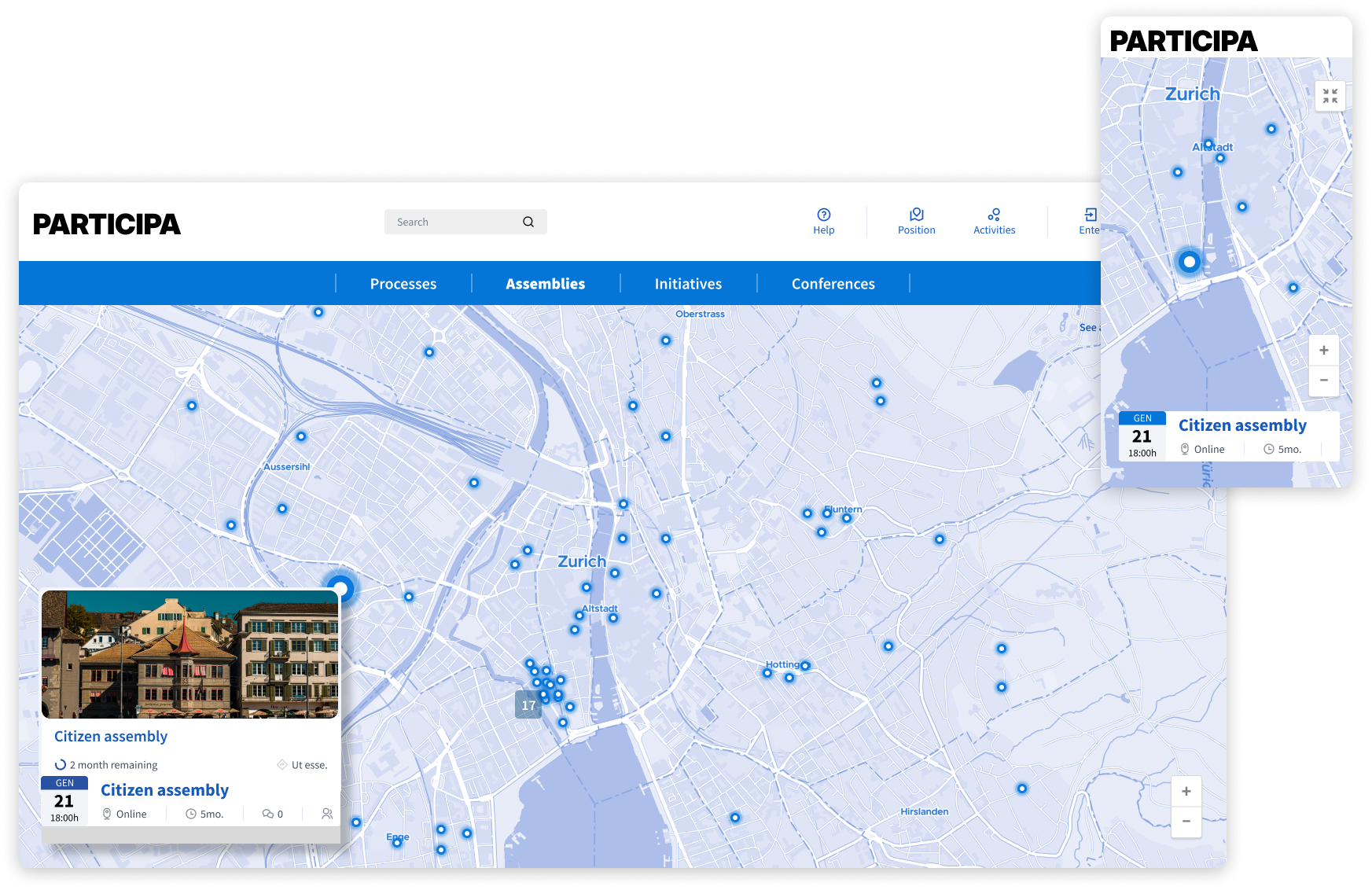
A plugin that puts participation on the map by adding interactive maps with a great mobile experience to your platform. Works with all Decidim platforms.

USED & SUPPORTED BY CITIEStransversal navigation
✓
based on Open Street Maps
✓
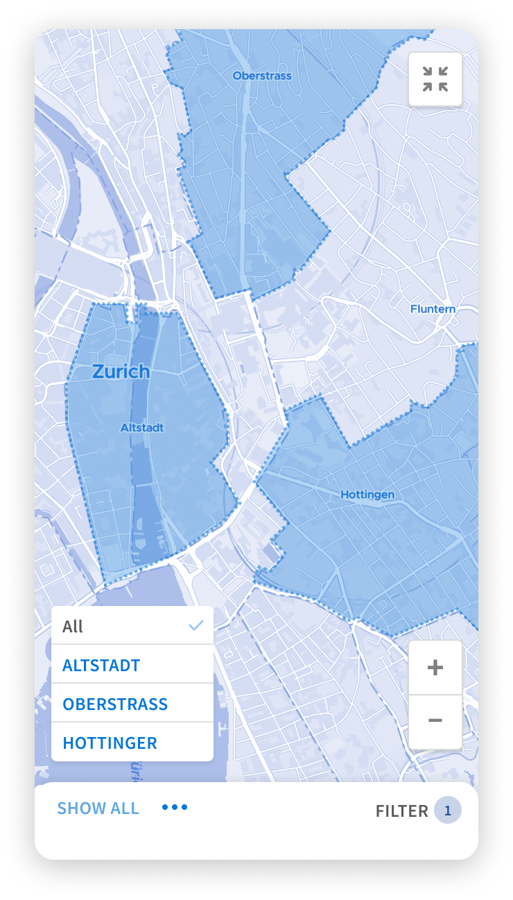
identify non-participation areas
✓
QGIS compatible
✓
bottom-linked participation ready
✓
cross-link activities
✓
local focus
✓
transversal navigation ✓ based on Open Street Maps ✓ identify non-participation areas ✓ QGIS compatible ✓ bottom-linked participation ready ✓ cross-link activities ✓ local focus ✓
features
Set up
Custom tiles and map providers
Upload custom shapefiles
Bind shapefiles to taxonomies
Set default map position
Set default zoom level
Machine translation ready
Import external QGis data
Configure
Homepage blocks
Hide points from outside a participatory space
Hide maps from process
Hide maps from a component
Separate processes and assembly points
Export QGis Data
Show maps in private spaces
Show maps in unpublished spaces
Participate
Search by keywords
Mobile-first UX
Browse by time
Browse by area
Browse by type
Browse non-geolocated points
✅
✅
✅
✅
✅
On request
On request
✅
✅
✅
✅
✅
On request
Funding needed
Funding needed
✅
✅
✅
✅
✅
✅

works with your stack


use cases
project follow-up
Make ongoing projects visible to participants in your city.
citizen proposals
Empower participants to map participatory content organically.
citizen observatories
Gather collective intelligence in-context, from the ground up.